top of page


Florida's 67 Counties and Their Histories
(In Alpabetical Order)

Historical Societies: Alachua County Genealogical Society - Gainesville, Florida
Major Historical Event(s): In 1824, Alachua County was created and named for the Seminole-Creek word meaning "jug", apparently in reference to the sinkholes common in the area. In 1539, Hernando De Soto passed through present-day Alachua County on his four-year exploration of the southeastern United States. The area now known as Paynes Prairie Preserve State Park was one of the last strongholds of the Alachua band of the Seminole Indians in the area.

Historical Societies: Baker County Historical Society
Major Historical Event(s): In 1861, Baker County was created and named for James McNair Baker, a Confederate senator and later a judge in the fourth judicial district. On February 20, 1864, Florida's largest battle of the American Civil War was fought in Baker County, which is known as the Battle of Olustee.

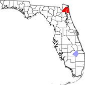
Major Historical Event(s): In 1913, Bay County was created and named for St. Andrew's Bay, the central geographic feature of the county. During World War II, Panama City became a shipbuiding, training and war industrial center, which prompted population and urban development growth in the Bay County area.

Historical Societies: Bradford County Historical Society
Major Historical Event(s): In 1858, New River County was created, but was soon renamed to Bradford County in 1861 for Captain Richard Bradford, who fought in the American Civil War and was killed in the Battle of Santa Rosa Island, becoming the first Confederate officer from Florida to die during the American Civil War.

Historical Societies: North Brevard Historical Society & Museum, Brevard Museum of History & Natural Science and the South Brevard Historical Society
Major Historical Event(s): In 1844, Brevard County was created and named for Theodore Washington Brevard, an early white settler and later state comptroller. In 1949, Cape Canaveral was chosen as the test site for U.S. government missile and rocket programs. NASA's Project Mercury, Gemini, Apollo and Space Shuttle flights were launched from Cape Canaveral as well.

Historical Societies: Historic Preservation Board of Broward County
Major Historical Event(s): In 1915, Broward County was created and named for Napoleon Bonaparte Broward, governor of Florida from 1905 to 1909. In 1825, Colonel James Gadsden, conducted the first survey in the present-day Broward County area. He was disappointed with the potential for development in the rugged area. Gadsen wrote, "...because the population of the route will probably never be sufficient to contribute to [its maintenance], while the inducements to individuals to keep up the necessary ferries will scarcely ever be adequate."

Historical Societies: Calhoun County Public Library
Major Historical Event(s): In 1838, Calhoun County was created and named for John C. Calhoun, a member of the United States Senate from South Carolina and the seventh U.S. vice president, who served under John Quincy Adams and Andrew Jackson.

Historical Societies: Charlotte County Historical Center Society
Major Historical Event(s): In 1921, Charlotte County was created and named for the Calusa, a group of Native Americans that were settled in the area. In 1565, the Spanish named "Bahia de Carlota," followed by the English in 1775 who named the area Charlotte Harbor in tribute to the Queen Charlotte Sophia, wife of King George III.

Historical Societies: Citrus County Historical Society
Major Historical Event(s): In 1887, Citrus County was created and was named for the county's citrus groves. The Citrus production declined dramatically after the "Big Freeze" of 1894-1895. Phosphate mining became the next major industry in the county, which continued until World War I.

Historical Societies: Clay County Historical Archives
Major Historical Event(s): In 1858, Clay County was created and named for Henry Clay, U.S. Secretary of State from 1825 to 1829. Clay County was once a popular destination for tourists because of its hot springs and mild climate. Steamboats brought them to various hotels in Green Cove Springs such as the St. Elmo, Clarendon, and the Oakland. President Grover Cleveland was the most prominent of such tourists and had spring water shipped to the White House. Clay County's popularity among tourists peaked during the last three decades of the 19th century. Tourism later waned because of Henry Flagler's extension of the Florida East Coast Railway to other destinations such as Palm Beach and Miami.

Historical Societies: Collier County Historical Society
Major Historical Event(s): In 1923, Collier County was created rom Lee County. It was named for Barron Collier, a New York City advertising mogul and real estate developer who had moved to Southwest Florida and established himself as a prominent landowner. He agreed to build the Tamiami Trail for what was then Lee County (comprising today's Collier, Hendry, and Lee Counties) in exchange for favorable consideration with the state legislature to have a county named for him.

Historical Societies: Lake City-Columbia County Historical Museum
Major Historical Event(s): In 1832, Columbia County was created from Duval and Alachua counties, Alligator Town was designated as the seat of the county government. It was renamed as Columbia, the poetic form for the United States. The county was developed for agriculture and the timber industry, with products such as turpentine, lumber, and plywood.

Historical Societies: DeSoto County Historical Society
Major Historical Event(s): In 1887, DeSoto County was created and named for Hernando de Soto, the Spanish explorer and conquistador. In 1539, Hernando de Soto anchored in Charlotte Harbor and set about to explore the region with mixed results. Eventually, he made his way up the coast to present-day Manatee County and went inland from there.

Historical Societies: Dixie County Historical Society
Major Historical Event(s): In 1921, Dixie County was created from the southern portion of Lafayette County and named for "Dixie," the common nickname for the southern United States. There are 2 sites on the National Register of Historic Places in Dixie County including the City of Hawkinsville (paddle steamer), which was constructed in Georgia in 1886 and abandoned in the middle of the Suwannee River in 1922 after it was rendered obsolete by the advent of railroads in the area.
Historical Societies: Historical Societies in Duval County
Major Historical Event(s): In 1822, Duval County was created and named for William Pope Duval, the first governor of the Florida Territory. This area had been settled by varying cultures of indigenous peoples for thousands of years before European contact. Within the Timucuan Ecological and Historic reserve in Jacksonville, archeologists have excavated remains of some of the oldest pottery in the United States, dating to 2500 BCE. Prior to European contact, the area was inhabited by the Mocama, a Timucuan-speaking group who lived throughout the coastal areas of northern Florida.

Historical Societies: Molino Mid-County Historical Society - Molino, Florida
Major Historical Event(s): In 1821, Escambia County was created and named possibly from the Native American word Shambia, meaning "clear water", or from the Spanish word “cambiar”, meaning to barter. Escambia County had been part of Spanish colonial settlement before it was acquired by the United States in 1818. Escambia and St. Johns counties were Florida's two original counties, covering the entire territory within modern state boundaries.

Historical Societies: Flagler County Historical Society
Major Historical Event(s): In 1917, Flagler County was created and named for Henry M. Flagler, the industrialist and founder of the Florida East Coast Railway company. In 1565, the Spanish massacred more than 230 French soldiers at Matanzas Inlet in present-day Flagler County (this incident is now known as the Matanzas Massacre). In 1972, the first homes were sold in Palm Coast, which has grown into the largest planned community in Florida's history.

Historical Societies: Apalachicola Area Historical Society
Major Historical Event(s): In 1832, Franklin County was created and named for Benjamin Franklin, the famous scientist, printer, and author and one of the Founding Fathers of the United States of America. In 1705, the Spaniards built a fort at the mouth of the Apalachieola River. This fort was destroyed by the Alibanos Indians, and rebuilt in 1719.

Historical Societies: West Gadsden Historical Society
Major Historical Event(s): in 1823, Gadsden County was created and named for James Gadsden, an American diplomat and namesake of the Gadsden Purchase. In 1824, the first capital of the new territory of Florida was established in Gadsden County. Early industries included shade tobacco and “Fuller’s Earth” (any clay material that has the capability to decolorize oil or other liquids without the use of harsh chemical treatment).

Historical Societies: Gilchrist County Public Library
Major Historical Event(s): In 1925, Gilchrist County was created and named for Albert W. Gilchrist , the 20th governor of Florida. It was the last (67th) county created in Florida. The Cannon Farm, an historic farmstead and former schoolhouse originally built in 1898, is the only site on the National Register of Historic Places in Gilchrist County.

Historical Societies: Glades County Historical Society
Major Historical Event(s): In 1921, Glades County was created and named for the Florida Everglades. In the eighteenth century, when Florida was under Spanish rule, Native American peoples of Creek and other tribes, and freed or runaway African slaves migrated into the present-day Glades County area (and other areas around Florida) and established maroon communities. All these people were forced off their lands during the Trail of Tears.

Historical Societies: Northwest Regional Library System
Major Historical Event(s): In 1925, Gulf County was created and named for the Gulf of Mexico. In 1717, the French built a fort named Crevecoeur a mile NW of St. Joseph Bay in present-day Gulf County. It was abandoned in 1718 by the request of the Spanish Governor in Pensacola, because it was on land belonging to his Catholic Majesty. The fort was occupied by the Spanish until 1722.

Historical Societies: Hamilton County Historical Society
Major Historical Event(s): In 1827, Hamilton County was created from portions of Jefferson County. It was named for Alexander Hamilton, the first United States Secretary of the Treasury.

Historical Societies: Hardee County Public Library
Major Historical Event(s): In 1921, Hardee County was created and named for Cary A. Hardee, Governor of Florida from 1921 to 1925.

Historical Societies: Hendry County Libraries
Major Historical Event(s): in 1923, Hendry County was created and named for Francis A. Hendry, an early white Floridian pioneer and politician. The present-day Hendry County was late for settlement as it was located in rugged areas in and near the Everglades. Between 1838 and 1841, Fort Donaud and Fort Thompson were established along the Caloosahatohoc River during the Second Seminole War.

Historical Societies: Hernando Historical Museum
Major Historical Event(s): In 1843, Hernando County was created and named for Hernando de Soto, the Spanish explorer and conquistador. Around 1840, Fort DeSoto was established in present-day Hernando County (present-day Brooksville) to protect settlers in the area from Native Americans during the Second Seminole War. Fort DeSoto became a small community center, trading post, and way station on the route to Tampa. Around 1845, a settlement around the fort became known as Pierceville.

Historical Societies: Sebring Historical Society
Major Historical Event(s): In 1921, Highlands County was created along with Charlotte, Glades, and Hardee counties, when they were separated from DeSoto County. It was named for the terrain in its general area.

Historical Societies:
Major Historical Event(s): On January 25, 1834, Hillsborough County was created from Alachua and Monroe Counties, and named for Wills Hill, the Earl of Hillsborough, who served as British Secretary of State for the Colonies from 1768 to 1772. On January 1, 1914, the St. Petersburg-Tampa Airboat Line initiated the first scheduled commercial airline service in the world, from St. Petersburg to Tampa.

Historical Societies: Holmes County Historical Society
Major Historical Event(s): In 1848, Holmes County was created. Its namesake is an open debate. Holmes Creek, the county's eastern boundary, bore that name before the county was created, but it was originally named Weekaywehatchee (a Creek Indian name meaning "spring creek").

Historical Societies: Indian River County Historical Society
Major Historical Event(s): In 1925, Indian River County was created from the northern portion of St. Lucie County, and named for the Indian River, which runs through the eastern portion of the county.

Historical Societies: History of Jackson County, Florida
Major Historical Event(s): In 1822, Jackson County was created by the Florida Territorial Council from parts of Escambia County. The county was named for President Andrew Jackson, who had served as Florida's first military governor for six months in 1821.

Historical Societies: Jefferson County History and Culure
Major Historical Event(s): In 1827, Jefferson County was created and named for Thomas Jefferson, third president of the United States, who had died the year before the county's establishment.

Historical Societies: Lafayette County Historical Society
Major Historical Event(s): In 1856, Lafayette County was created from part of Madison County and named in honor of the Marquis de Lafayette, the French general who rendered assistance to the Continental Army in the American Revolutionary War.

Historical Societies: Lake County Historical Museum
Major Historical Event(s): In 1887, Lake County was created from portions of Sumter and Orange counties and named for the many lakes contained within its borders. In the 1800s, the two main industries in the area were growing cotton and breeding cattle. In the latter part of the 19th century, people started to grow citrus trees. Throughout the 1940s and 50s, citrus production increased and grew into the area's leading industry.

Historical Societies: Southwest Florida Historical Society
Major Historical Event(s): In 1887, Lee County was created and named for for Confederate General Robert E. Lee. In 1821, after Florida became a U.S. territory white settlers moved into Florida, causing conflict with the local Seminole Indians. Fort Myers was built in 1850 as a military fort to fend off Seminole Indians during the Seminole Wars. In 1863, the fort was reoccupied by federal troops during the American Civil War. In 1865, in the Battle of Fort Myers, the fort was attacked by a small group of Confederates. The Union's garrison, led by Captain James Doyle, successfully held the fort and the Confederate forces retreated.

Historical Societies: Tallahassee Historical Society
Major Historical Event(s): In 1824, Leon County was created from parts of Escambia County and named for Juan Ponce de León, the Spanish explorer who claimed Florida for the Spanish Empire. By the 1850s and 1860s, Leon County had become part of the "cotton kingdom" of the Deep South. During the American Civil War Tallahassee, the capital of Florida, was not captured by Union forces.

Historical Societies: Levy County Historical Society
Major Historical Event(s): In 1845, Levy County was created in 1845 and named for David Levy Yulee, a planter elected in 1841 as the state's territorial delegate to the US House of Representatives. During the first week of January 1923, the Rosewood Massacre occurred in Levy County. White citizens from the nearby town of Sumner, reacting to a what turned out to be a false accusation that a black man raped a white woman, burned the predominantly black town of Rosewood to the ground and brutally murdered several of Rosewood's black citizens.

Historical Societies: Northwest Regional Library System
Major Historical Event(s): In 1855, Liberty County was created and named for the American ideal of liberty. Liberty County has 4 sites on the National Register of Historic Places including the United States National Natural Landmark and historic site:Torreya State Park.

Historical Societies: The Treasures of Madison County Museum
Major Historical Event(s): In 1827, Madison County was created and named for James Madison, the fourth President of the United States. During the late 19th century into the early 20th century, racial violence escalated in the area and at least 16 black people were lynched in Madison County.

Historical Societies: Manatee County Historical Society
Major Historical Event(s): In 1855, Manatee County was created and named for the Florida manatee (Florida's official marine mammal). In 1842, the first two white settlers were Joseph Braden and Hector Braden who moved into an area near the Manatee River. The two had lost their land and plantations in Northern Florida during the Panic of 1837, and moved south to start a new life.

Historical Societies: Historic Ocala Preservation Society
Major Historical Event(s): In 1844, Marion County was created and named for Francis Marion (also known as the Swamp Fox), who was a military officer who served in the American Revolutionary War. Prior to the American Civil War, Marion County was a hotbed of secessionist activity. Organizers petitioned the state to host the Florida Secession Convention and break away from the United States with other Southern states. The area had many plantations and more than half of the population was enslaved African Americans.

Historical Societies: Historical Society of Martin County
Major Historical Event(s): In 1925, Martin County was created in 1925 with the northern portion coming from St. Lucie County and southern portion coming from Palm Beach County and named for John W. Martin, Governor of Florida from 1925 to 1929.

Historical Societies: Miami-Dade Historic Preservation
Major Historical Event(s): In 1836, Miami-Dade County was created and named for the City of Miami and Francis L. Dade, a Major in the United States Army, who was killed in a battle known as the "Dade Massacre" during the Second Seminole War. The inhabitants in the present-day Miami-Dade County at the time of European contact in 1513 were the Tequesta people, who controlled much of southeastern Florida.

Historical Societies: Key West Art & Historical Society
Major Historical Event(s): In 1823, Monroe County was created and named for James Monroe, the fifth president of the United States. Two thirds of the large area in what local residents call "mainland Monroe" remains uninhabited by virtue of being part of the Everglades National Park, and the remainder by the Big Cypress National Preserve in the northeastern interior.

Historical Societies: West Nassau Historical Society
Major Historical Event(s): In 1824, Nassau County was created in 1824 and named for the Duchy of Nassau in Germany. On June 30, 1778, the Battle of Alligator Bridge took place in present-day Nassau County around Callahan. This was the only major engagement in an unsuccessful campaign to conquer British East Florida during the American Revolutionary War.

Historical Societies: Panhandle Historic Preservation Alliance
Major Historical Event(s): In 1915, Okaloosa County was created and named for the Choctaw word meaning "black water." Okaloosa County has 9 sites on the National Register of Historic Places including the U.S. historic district: Camp Pinchot Historic District.

Historical Societies: Okeechobee County Historical Society
Major Historical Event(s): In 1917, Okeechobee County was created and named for Lake Okeechobee, which originated from the Hitchiti words for "big water." Okeechobee is close to the site of the Battle of Lake Okeechobee, a major battle of the Second Seminole War, fought between forces under the command of Zachary Taylor and Seminole warriors resisting forced relocation to Oklahoma Territory.

Historical Societies: Orange County Regional History Center
Major Historical Event(s): In 1824, Orange County was created and named for the fruit that was the county's main product. During the late 19th century into the early 20th century, racial violence escalated in the area and at least 33 black people were lynched in Orange County. In 1971, the economy of Florida was changed when Walt Disney World opened (most of it is in Orange County and a portion in Osceola County).

Historical Societies: The Osceola County Welcome Center and History Museum
Major Historical Event(s): In 1887, Osceola County was created and named for Osceola, a war leader of the Seminoles during the Second Seminole War. Osceola County has 10 sites on the National Register of Historic Places including the U.S. historic district: the Kissimmee Historic District.

Historical Societies: Historical Society of Palm Beach County
Major Historical Event(s): In 1909, Palm Beach County was created and named for the county's large amounts of palm trees. Henry Flagler, who was instrumental in the county's development in the late 19th century and early 20th century, first visited in 1892. He subsequently purchased land on both sides of Lake Worth.

Historical Societies: Pasco County Historical Society
Major Historical Event(s): In 1887, Pasco County was created named for Samuel Pasco, who had just been elected to the United States Senate. Citrus was an important industry when the county was formed, although a decline followed a freeze in 1895. Several large sawmills operated in the county in the early part of the 20th century.

Historical Societies: Pinellas County Historical Society
Major Historical Event(s): In 1912, Pinellas County was created and named for the Spanish Punta Piñal, or "Point of Pines." During World War II, the area's tourist industry collapsed, but thousands of recruits came to the area when the U.S. military set up training facitlies in the area. Most of the area's hotels became barracks for military personnel.

Historical Societies: Polk County Historical Association
Major Historical Event(s): In 1861, Polk County was created and named for James K. Polk the 11th President of the United States. Bartow, the county seat, was named after Francis S. Bartow, a Confederate colonel from Georgia who was the first Confederate brigade commander to die in battle.

Historical Societies: Putnam County Historical Society
Major Historical Event(s): In 1849, Putnam County was created and named for Benjamin A. Putnam, who was an officer in the Second Seminole War, a lawyer, Florida legislator, and the first president of the Florida Historical Society. During the Second Seminole War, the U.S. Army built Fort Shannon, one of the largest supply depots and regional headquarters, in Palatka along the St. Johns River.

Historical Societies: Santa Rosa Historical Society
Major Historical Event(s): In 1842, Santa Rosa County was created and named for the Roman Catholic saint, Rosa de Viterbo. Santa Rosa County has 18 sites on the National Register of Historic Places including the First American Road in Florida (also known as the Andrew Jackson Trail or Military Road), which is in Gulf Breeze, Florida.

Historical Societies: The Historical Society of Sarasota County
Major Historical Event(s): In 1921, Sarasota County was created and named for the Manatee Native American word "Sarasota", which was an indigenous word for this area, however its meaning is unknown. In 1886, Joseph Daniel Anderson was one of the first white pioneers of the present-day Sarasota County area as he established a homestead in the Forked Creek area.

Historical Societies: Seminole County Historical Society
Major Historical Event(s): In 1913, Seminole County was created and named for the Seminole Native American tribe. There are 17 sites on the National Register of Historic Places in Seminole County including the Bradlee-McIntyre House (a Victorian Cottage Style house) located in Longwood, Florida.

Historical Societies: St. Augustine Historical Society
Major Historical Event(s): In 1821, St. Johns County was created from the former East Florida province. The name Saint John's was derived from the Spanish mission (ca. 1580) San Juan del Puerto or Saint John of the Harbor. The apostrophe was dropped in 1932 by the U.S. Department of the Interior because an apostrophe implied ownership.
Escambia and St. Johns counties were Florida's two original counties, covering the entire territory within modern state boundaries. It was a huge county, encompassing most of peninsular Florida (more than 39,000 square miles) and was 475 miles long by 165 miles wide.

Historical Societies: St. Lucie Historical Society
Major Historical Event(s): In 1905, St. Lucie County was created and named for Saint Lucy, the Christian martyr. The area was given several names by the Spanish including Rio de Ays (later changed to Indian River) as well as Santa Lucia, named after the short-lived late 16th-century Spanish fort that bore its name farther south. The fabled 1715 Spanish treasure fleet sank off the area that is now St. Lucie County, leading to the regional naming of the area as the Treasure Coast.

Historical Societies: Sumter County Historical Society
Major Historical Event(s): In 1853, Sumter County was created and named for General Thomas Sumter, a general in the American Revolutionary War. The county in the past, and to this day by some, is nicknamed "Hog County" most likely because it is home to a large population of wild hogs.

Historical Societies: Suwannee County Historical Commission
Major Historical Event(s): In 1858, Suwannee County was created and named for the Suwannee River, a 266-mile long river in northern Florida. The word "Suwannee" may either be a corruption of the Spanish San Juan ("Saint John") or from the Cherokee sawani ("echo river"). In the late 19th and early 20th century the rural areas of this county supported numerous lumber and turpentine camps.

Historical Societies: Taylor County Historical Society
Major Historical Event(s): In 1856, Taylor County was created and named for Zachary Taylor, twelfth President of the United States of America, who served from 1849 to 1850. Taylor County has 3 sites on the National Register of Historic Places including the old Taylor County Jail.

Historical Societies: Union County Historical Society
Major Historical Event(s): In 1921, Union County was created and named for the concept of unity. Union County has 4 sites on the National Register of Historic Places including the Townsend Building (also known as the Old Drugstore).

Historical Societies: Halifax Historical Museum
Major Historical Event(s): In 1854, Volusia County was created and named for the port of Volusia, whose etymology is uncertain; possibly derived from the Native American word for "Land of the Euchees," the term for the area's native inhabitants. During the British occupation of Florida, a colony known as New Smyrna was started in southeast Volusia County by Andrew Turnbull. This colony was connected to St. Augustine, the capital of East Florida, via the Kings Road.

Historical Societies: Wakulla County Historical Society
Major Historical Event(s): In 1843, Wakulla County was created and named for the Wakulla River, itself named for a Spanish misinterpretation of a Timucuan word used to describe the body of water, but that is of uncertain meaning. In 1818, General Andrew Jackson invaded the area, capturing Fort San Marcos. Two captive British citizens, Robert Ambrister and Alexander Arbuthnot, were tried, found guilty of inciting Indian raids, and executed under Jackson's authority – causing a diplomatic nightmare between the U.S. and Britain. The U.S. Army garrison of 200 infantry and artillery men occupied the fort for the better part of a year (1818-1819).

Historical Societies: Walton County Heritage Association
Major Historical Event(s): In 1824, Walton County was created and named for George Walton, first Secretary of Florida Territory. Between 1763 and 1783 the territory that has since become Walton County was part of the colony of British West Florida. During this time British settlers permanently settled in the area, becoming the first English-speaking people to permanently reside in what is now Walton County.

Historical Societies: Washington County Historical Society
Major Historical Event(s): In 1825, Washington County was created and named for George Washington, first President of the United States. The area's first white settlers were seeking both economic and political freedom in this frontier land of vast timber and mineral resources. Inland waterway transportation brought about heavy river settlements. The arrival of railroads in the late 1800s boosted economic, social and political developments.
bottom of page